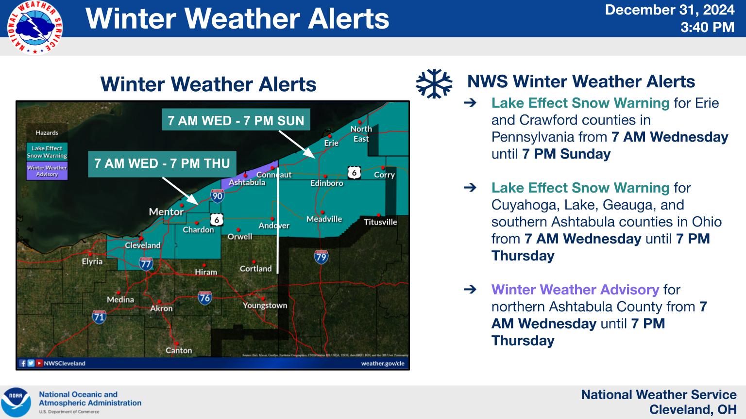
What is a Lake Effect Snow Warning?
A Lake effect snow warning is issued by the National Weather Service (NWS) when significant snowfall is expected due to the lake-effect phenomenon. This meteorological event occurs when cold, dry air masses move over relatively warmer lake waters. The air picks up moisture and warmth, becoming unstable and leading to intense snowfall downwind of the lake. These warnings are not issued lightly; they indicate a serious threat to life and property, predicting significant accumulation within a short timeframe. Understanding these warnings is crucial for preparation and safety.
Understanding the Causes of Lake Effect Snow
The key ingredients for Lake effect snow are cold air, relatively warm lake water, and sufficient fetch (the distance the wind travels over the lake). Cold air masses moving over warmer water are rapidly destabilized, creating turbulent updrafts that lead to cloud formation. As the moist air rises and cools, it condenses and precipitates as snow. The longer the air mass travels over the lake (greater fetch), the more moisture it absorbs, resulting in heavier snowfall. The orientation of the wind relative to the lake's long axis is also crucial; winds parallel to the longer axis usually produce the most intense snow bands.
Impact of Lake Effect Snow Warnings
The impacts of a Lake effect snow warning can be significant and wide-ranging. Travel becomes extremely dangerous, with roads quickly becoming impassable. Power outages are common due to heavy snow accumulating on power lines. Schools and businesses often close, and disruptions to daily life are widespread. The heavy snowfall can lead to property damage, including roof collapses from the weight of the snow. Furthermore, blizzards associated with these events reduce visibility drastically, making driving conditions exceedingly perilous.
Staying Safe During a Lake Effect Snow Warning
Preparing for a Lake effect snow warning involves several key steps. Before the storm hits, stock up on essential supplies including food, water, medications, and batteries. Ensure your vehicle is winterized, with a full tank of gas, winter tires, and an emergency kit. Stay informed about the latest weather forecasts and warnings through reliable sources like the NWS. During the storm, stay indoors unless absolutely necessary. If you must travel, exercise extreme caution and be aware of rapidly changing conditions.
Preparing Your Home for Lake Effect Snow
Protecting your property during a Lake effect snow warning is equally important. Clear gutters and downspouts to prevent ice dams. Bring in any outdoor furniture or decorations that could be damaged by the snow. If you have a fireplace, ensure you have a sufficient supply of firewood. Consider purchasing a generator in case of a power outage. Remember that prevention is key and that proactive measures can significantly reduce the impact of heavy snowfall.
When and Where Lake Effect Snow Occurs
Lake-effect snowstorms are a common occurrence in certain regions, particularly areas downwind of the Great Lakes in the United States and Canada. The timing of these storms is often dictated by the arrival of cold air masses during the late fall and winter months. Locations with prolonged periods of cold air masses moving across large bodies of relatively warm water, such as Lake Erie and Lake Ontario, are particularly susceptible to intense snowfall events. Understanding the geographical areas prone to these phenomena helps communities prepare and mitigate potential impacts.


0 Comments